
REVISED PROPOSED FUTURE LAND USE MAP NOW AVAILABLE FOR COMMUNITY REVIEW
8/10/2022
The Town of Greenevers has released a revised proposed Future Land Use map for the community to review. The primary objective of the revised map is to meet the projected job and housing needs of the community. The revised map reflects the following changes:
- Removal of the mixed-use designation and replaced with the residential designation on Carr Town Road, Cedar Lane, and Hargroves Drive.
- Reduction of the mixed-use designation and replaced with the residential designation on Clinic Circle Drive and E. Charity Road.
A copy of the revised map is available for review at the Town of Greenevers, 314 E Charity Road, Rose Hill, NC 28458. The plan is also available on the Town of Greenevers’ website at https://townofgreenevers.com/planning-board. The public is invited to speak on the revised map at the public hearing scheduled for Monday, August 15, 2022. Written comments may be submitted prior to, or at the public hearing. Any questions, written comments, or requests for a copy of the proposed revised map should be directed to the Town of Greenevers at (910)289-3078 or townofgreenevers@centurylink.net. Written comments will be given the same weight as oral testimony and be part of the public record. Written comments need to be received by the end of the day on Friday, August 12, 2022.
The Planning Board and Town Board will review the comments received prior to adoption of the revised map. The Planning Board and Town Board may take action to adopt the revised map immediately following the public hearing.
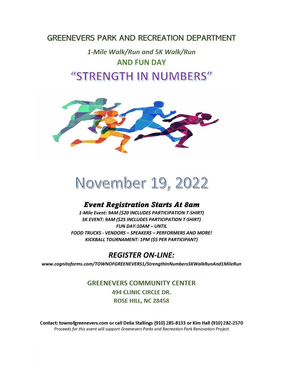 GREENEVERS PARKS REC 5K WALK RUN
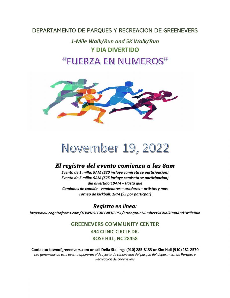 5K WALK/RUN SPANISH